|
|
本帖最后由 和解团结 于 2009-10-24 20:25 编辑
【英文标题】Two Countries, Three Maps
【出版媒体】Wall Street Journal--China Real Time Report
【原文链接】http://blogs.wsj.com/chinarealti ... untries-three-maps/
【作者】Sky Canaves
【原文】
While China and India continue to haggle over a long-running border dispute, Google (GOOG) is treading gently on this sensitive territory.
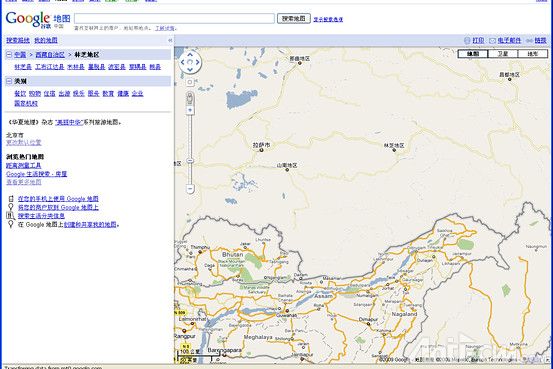
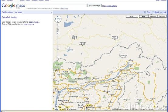
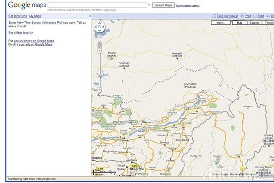
A story on PC World’s Web site highlights how Google addresses the challenge of demarcating the borders in the disputed region that straddles northeastern India and southwestern China. The Chinese version of Google Maps places the region within China’s borders, the Indian version marks the state of Arunachal Pradesh as part of India, while the global version uses dotted lines to indicate the uncertainty, as seen in the screen shot images below.

The Chinese Google map

The Indian Google map

Google’s International map
A Google spokeswoman said that Google’s localized products in different countries will depict that country’s official position, according to the report, while the global version of Google adheres to a standard practices of showing all disputed regions around the world.

|
Countries, Maps, Three, Two, 华尔街日报, Countries, Maps, Three, Two, 华尔街日报, Countries, Maps, Three, Two, 华尔街日报
评分
-
1
查看全部评分
-
|